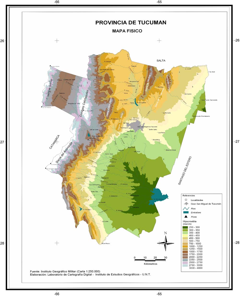
Mapa Fisico de la Provincia de Tucumán
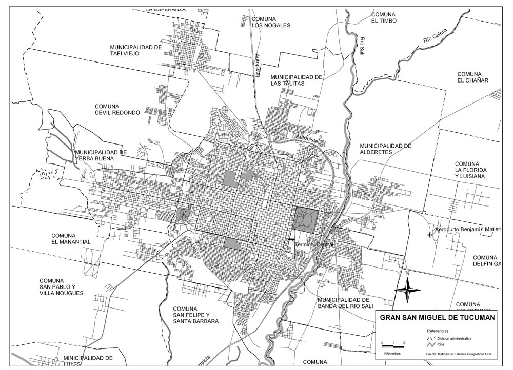
Plano del Gran San Miguel de Tucumán
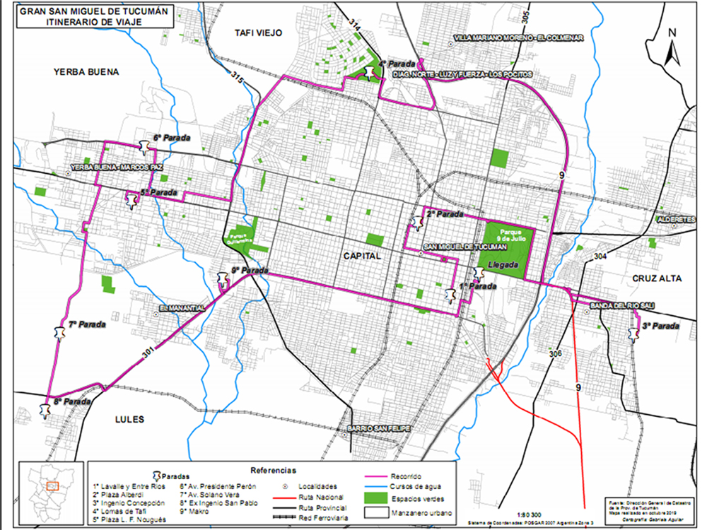
Plano de San Miguel de Tucumán - Geografía Urbana - UNT
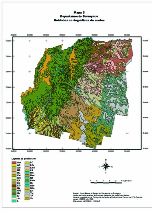
Mapa de Suelos del Departamento Burruyacu - Tucumán
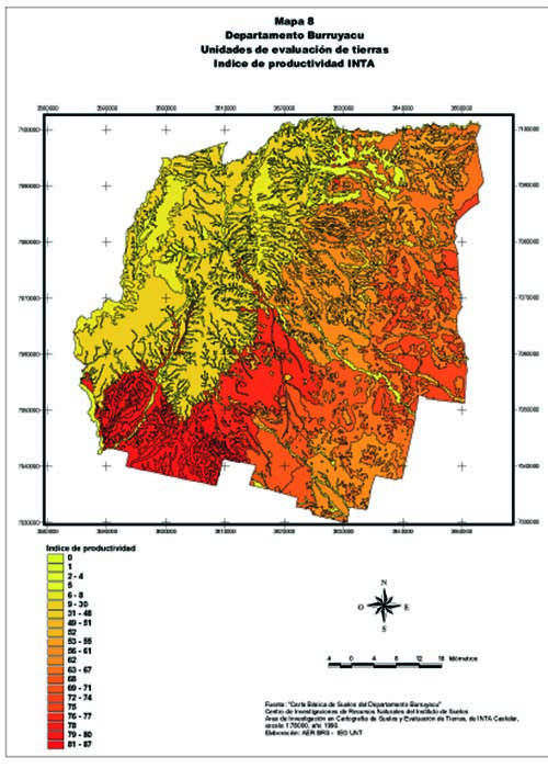
Indice de Productivida INTA - Departamento Burruyacu - Tucumán
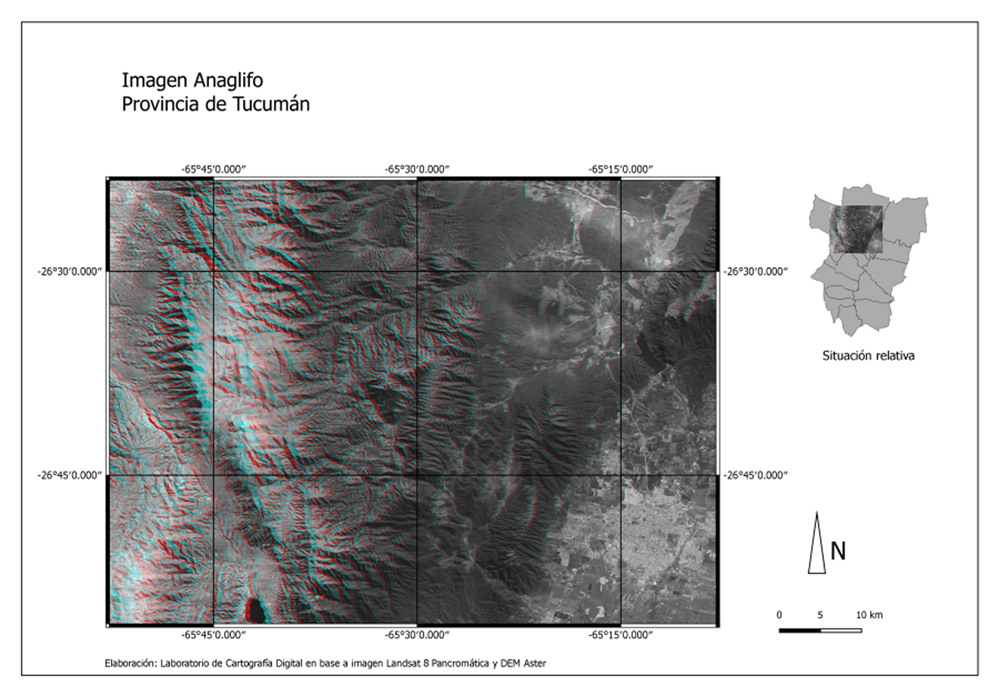
Anaglifo - Cumbres Calchaquíes - Sierra de San Javier - San Miguel de Tucumán - Provincia de Tucumán
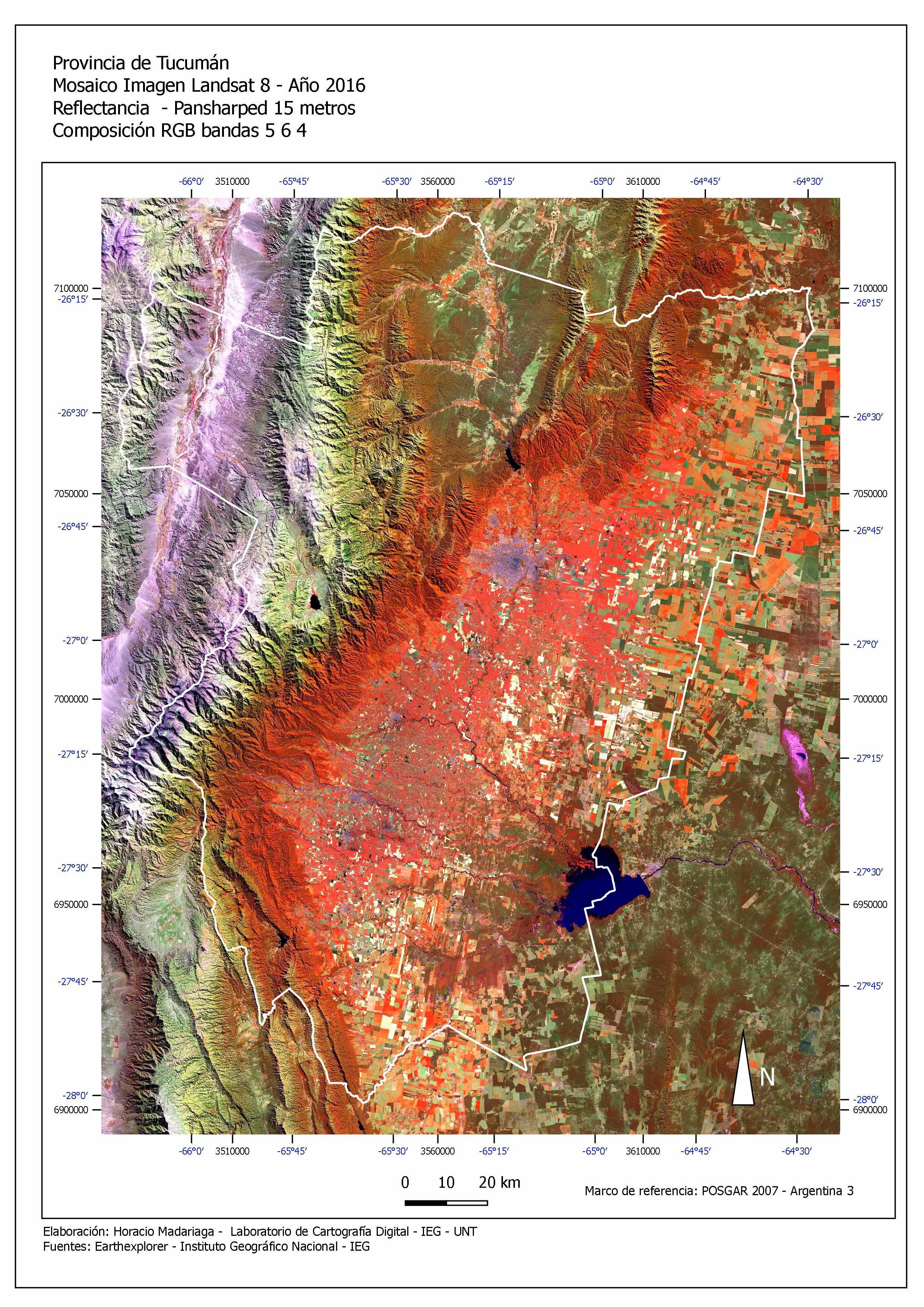
Mosaico Landsat 8 - Pansharped - Fecha 2016 - Provincia de Tucuman
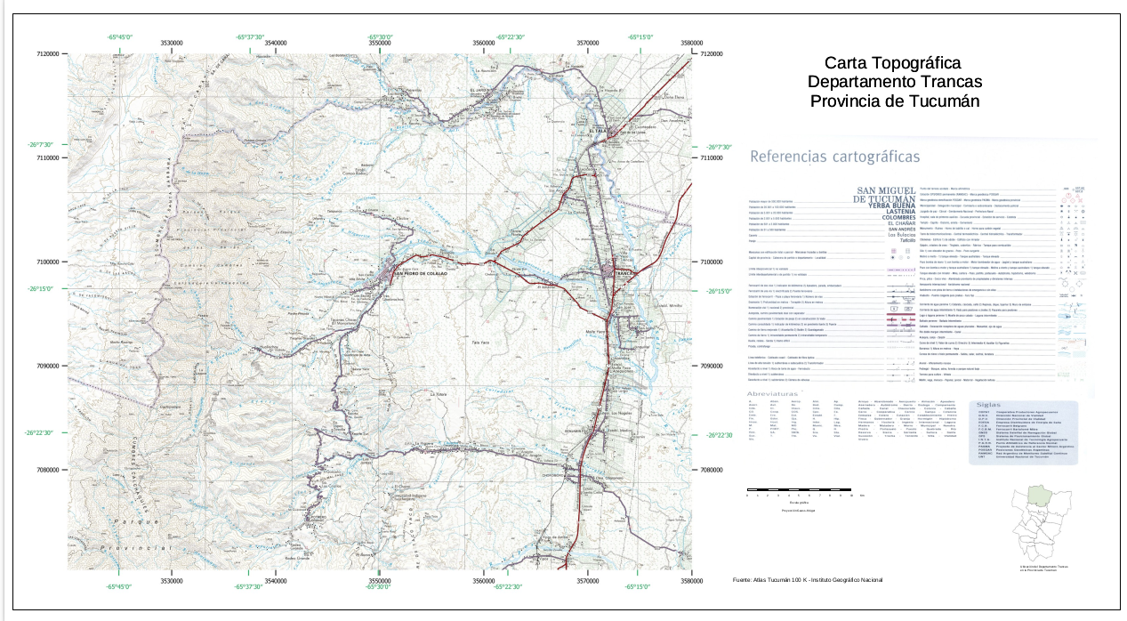
Carta Topografica Departamento Trancas - Provincia de Tucumán
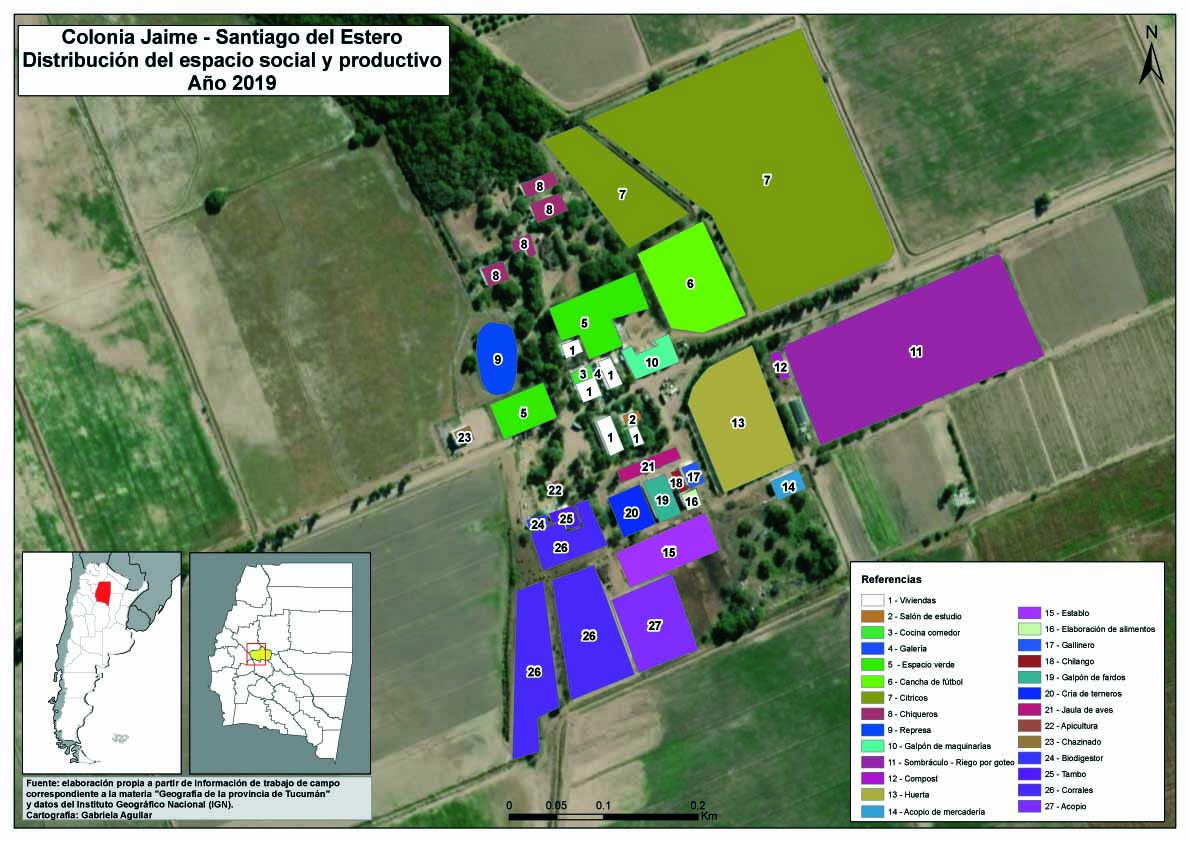
Colonia Jaime - Sgo. del Estero - Distribución del espacio social y productivo - Autor: Gabriela Aguilar
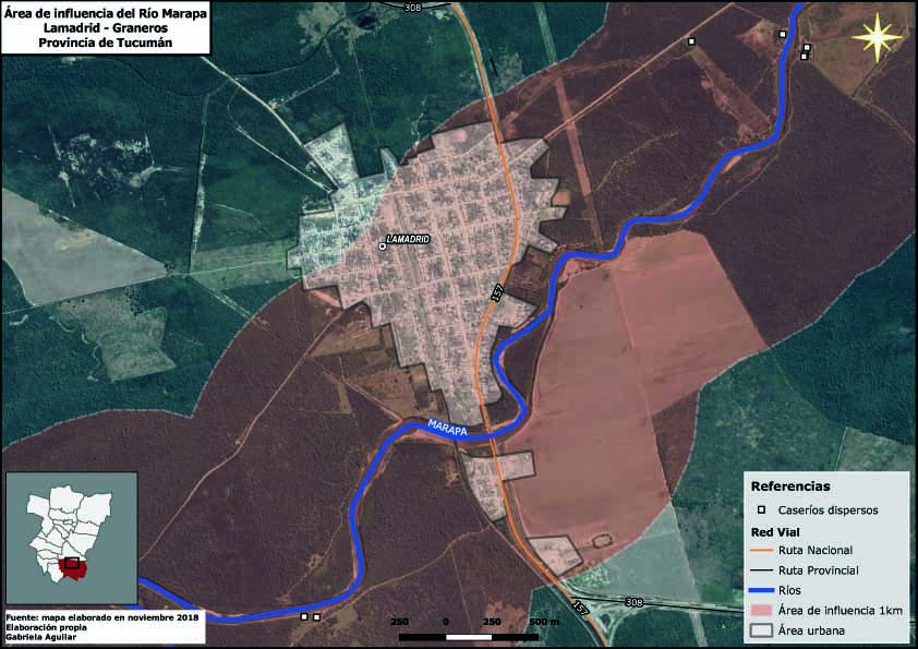
Area de influencia del Rio Marapa - Lamadrid - Tucuman - Autor: Gabriela Aguilar
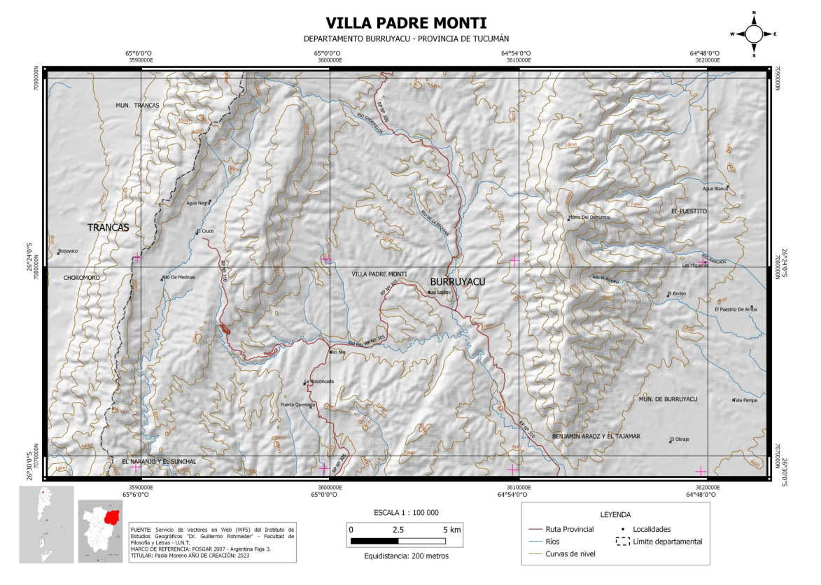
Villa Padre Monti - Carta topográfica - Autor: Paola Moreno
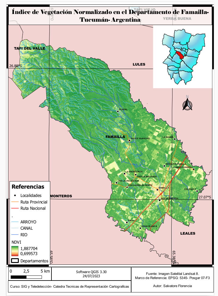
Indice de Vegetacion - Mun. de Famaillá - Autor: Florencia Salvatore
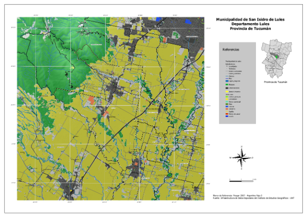
Municipio de Lules - Autor: Horacio Madariaga
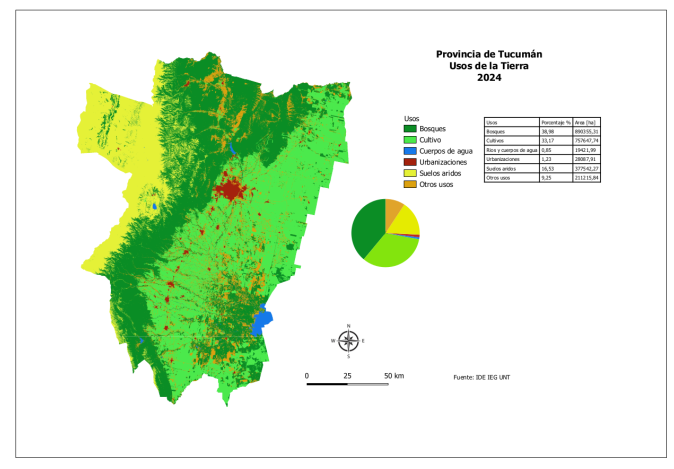
Mapa de Usos de La Tierra - Tucuman 2024 - Autor: Horacio Madariaga
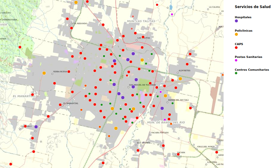
MAPA INTERACTIVO: Serv. de Salud de la Provincia de Tucumán
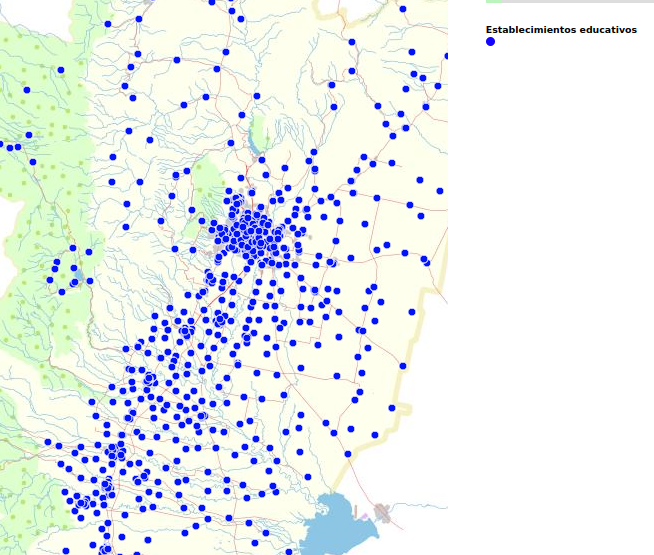
MAPA INTERACTIVO: Establecimientos Educativos de la Provincia de Tucumán
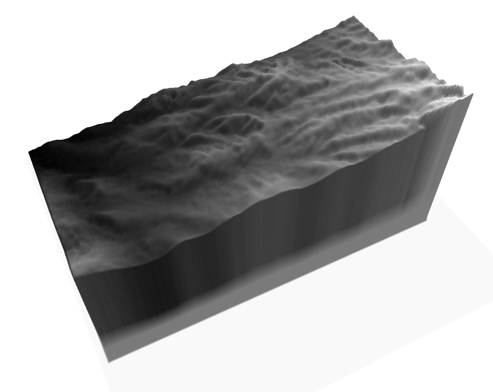
MAPA 3D INTERACTIVO: Recorte MDT quebrada de Lules - Provincia de Tucumán
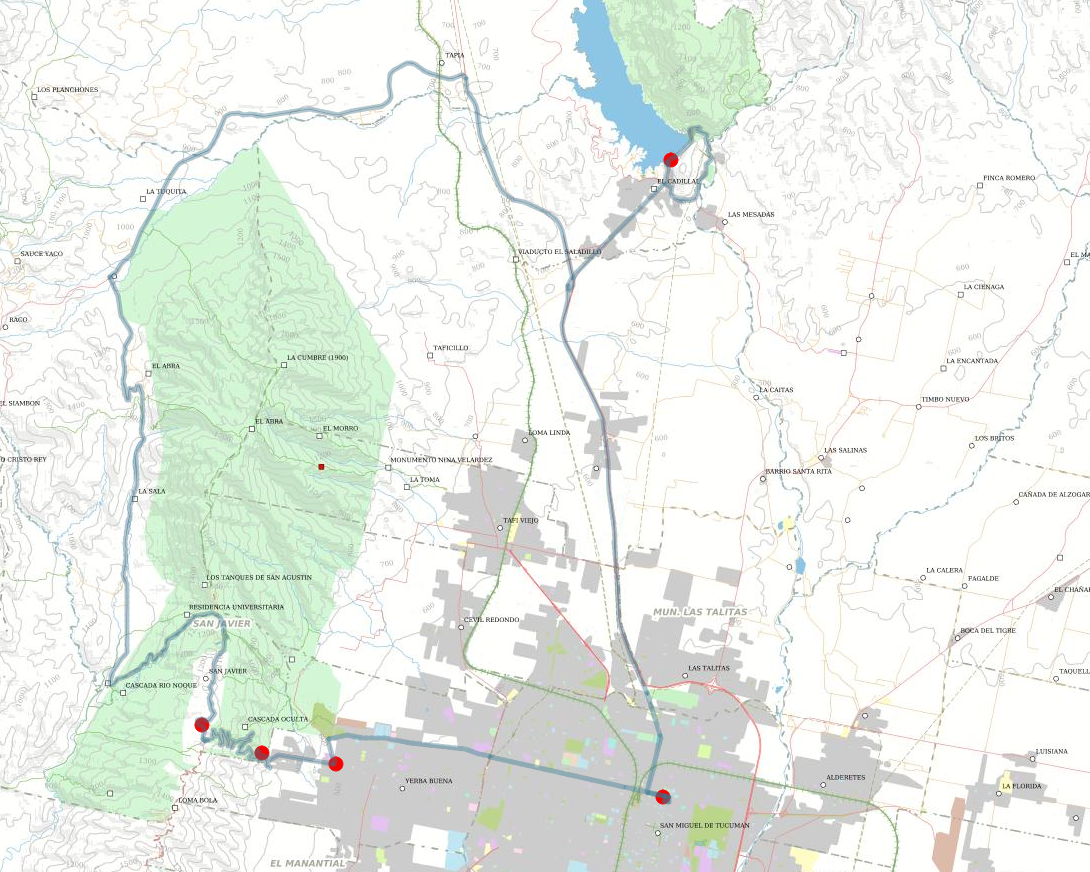
MAPA INTERACTIVO: Visita Circuito San Javier - El Cadillal
Instituto de Estudios Geográficos UNT